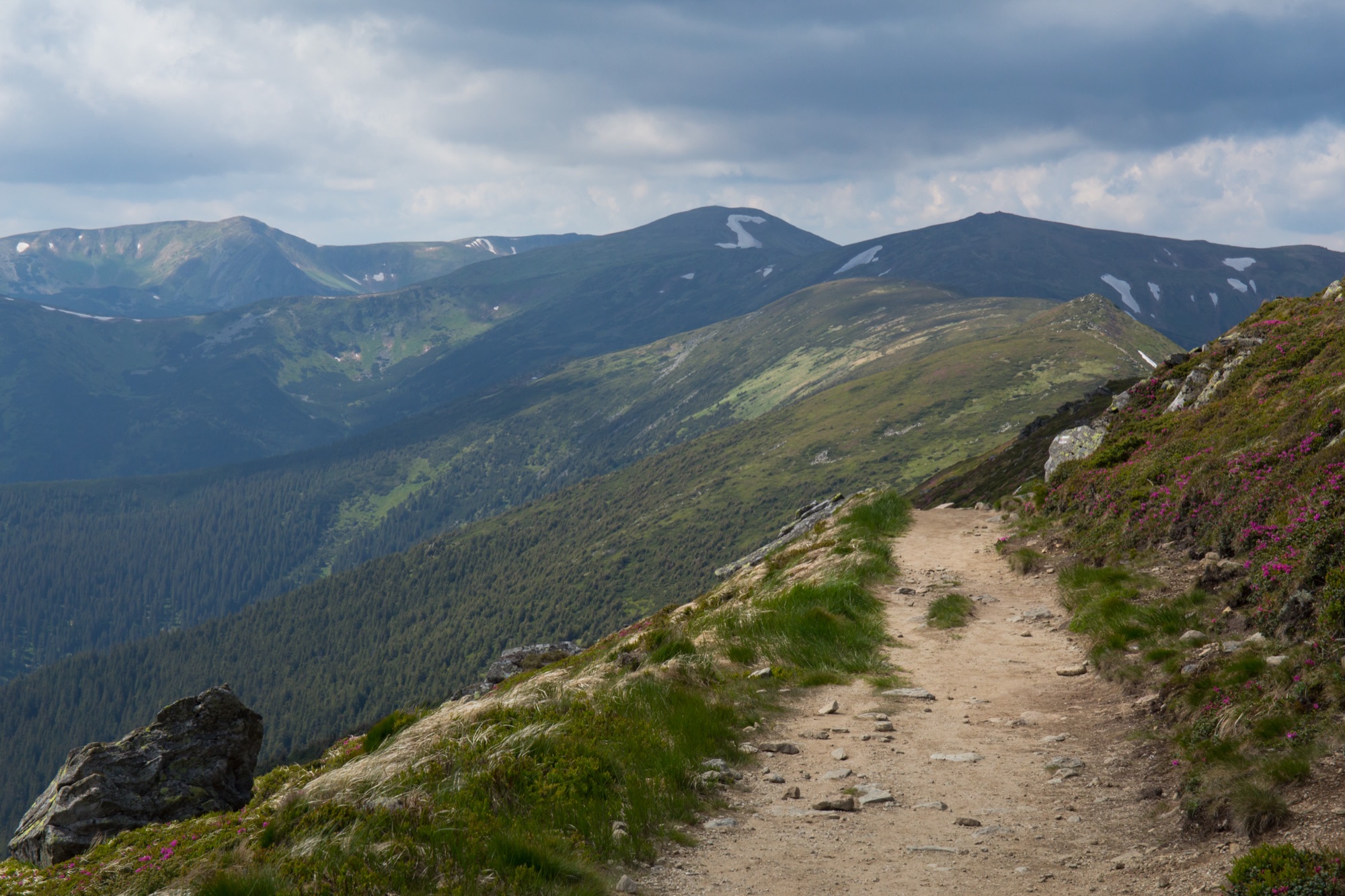
Zaroslyak — Upper Dzembronya · one way
- Distance
- 31.5 km · one way
- Elevation gain
- ↑ 1941 m
- On the trail
- 2 days
- Highest point
- 2061 m
- Trailhead elevation
- ~1265 m · Zaroslyak
- Max steepness
- ≈59% over 200 m
- Difficulty
- Hard
ROUTE OVERVIEW
Along the Chornohora main ridge — from Ukraine's highest summit to the observatory on Pip Ivan.
The Chornohora traverse follows the main ridge from Hoverla (2061 m), Ukraine's highest summit, to Pip Ivan Chornohirskyi (2028 m). It runs one way: the start is at the Zaroslyak base, the finish in Upper Dzembronya, 31.5 km along the OpenStreetMap track.
From Zaroslyak the blue trail climbs Hoverla. There is a green one too, longer and gentler; it only skirts the shoulder of Mala Hoverla from the border-zone list, so it needs no separate permit. From Hoverla the red trail, the Transcarpathian Tourist Trail, runs south-east along the ridge, 18 km to Pip Ivan. It crosses the tops of Breskul, Pozhyzhevska, Dantsyzh, Turkul and Mount Dzembronya, and skirts Rebra, Brebeneskul and Menchul on their slopes, 140–270 m off the summits. The lowest point of the ridge is the saddle between Pozhyzhevska and Dantsyzh, about 1725 m. Old border posts stand along the crest.
From Pip Ivan the red turns back 1.2 km to the «Sidlovyna» post, where the yellow trail leaves the ridge, and the blue leads past Vukhatyi Kamin and the Dzembronya waterfalls to Upper Dzembronya. The other branch of the blue goes over the top of Smotrych, 1.3 km shorter. Between the Vukhatyi Kamin rock and the pass there are no waymarks (Marian Slabinoha, 2023).
Wikipedia gives times along the ridge: mostly about an hour between neighbouring summits, about 10 hours in all from Hoverla to Pip Ivan. With the climb up Hoverla and the way down to Dzembronya that makes about 18 hours of walking. Most people split it into two days (gorskaprzygoda.pl, 2018). Some sections of the ridge are easy, as Slabinoha describes them — gentle slopes and little climbing. What makes the traverse hard is its length and a pack with a tent. Polish hikers who walked the ridge from Hoverla to Pip Ivan in a single day called it exhausting.
There are no permanent shelters on the ridge. State Emergency Service rescuers have been on duty on Pip Ivan round the clock since 2017, but the observatory does not take hikers for the night: in 2018 and in 2026 alike, the rescuers suggested pitching a tent. The Carpathian National Nature Park asks for tents only in approved recreation zones, the Carpathian Biosphere Reserve only along approved routes. Neither publishes a list of such places on the ridge between Hoverla and Pip Ivan. Hikers camp by Lake Nesamovyte, about a third of the way along the ridge, below Turkul: there is a spring that never dries but no firewood, so cooking is on a gas stove (Slabinoha). The other popular camp is Lake Brebeneskul, in a cirque below the ridge.
Water on the ridge is by Nesamovyte and at a spring on the south-west slope of Brebeneskul. In July hikers write that there are plenty of springs; at the end of September, that there is water but not everywhere.
Between the «Below Rebra» signpost and Sidlovyna below Pip Ivan, 9.5 km, there is no quick way off the ridge: the yellow trail across the Brebeneska meadow has gaps, and hikers describe the path down the Brebeneskul stream to Luhy as washed out.
The weather on the ridge turns fast: a thunderstorm with hail and squalls can blow in within 20–30 minutes even on a clear day, and fog sets in suddenly. In bad weather the reserve advises getting off the ridge into the forest — by a waymarked trail to the nearest descent, never straight down the slope: in fog that is how people get lost in the valleys. In June snow still lies on the slopes and by the lakes.
In autumn daylight shrinks from 13.4 hours in early September to 8.7 by late November. From late October it is shorter than the 10 hours along the ridge from Hoverla to Pip Ivan, and by late November shorter than half of the whole way, about 9 hours. So late in autumn part of the way will most likely be walked in the dark: carry a headlamp.
Breskul, Pozhyzhevska, Turkul, Brebeneskul, Menchul, Pip Ivan and Vukhatyi Kamin lie in the border zone, where you are not let in without a permit from the border guards.
- Hoverla (2061 m) is the highest point of the route and of Ukraine
- From Hoverla to Pip Ivan it is 18 km on the red trail along the Chornohora main ridge
- Between Pozhyzhevska and Dantsyzh lies the lowest saddle of the Chornohora ridge, about 1725 m
- The red trail skirts Rebra, Brebeneskul and Menchul on their slopes and crosses the tops of the other ridge summits
Elevation profile
31.5 km · one way · ↑ 1941 m · ↓ 2406 m
Route map
All routes on the mapSTAGE BY STAGE
- 0 kmZaroslyakTrailhead at the «Start to Hoverla» sign; the blue trail leads up Hoverla~1265 m
- 3.2 kmHoverlaThe highest point of the route and of Ukraine. From here the red trail runs south-east along the ridge2061 m
- 4.6 kmBreskulSummit, 1911 m, on the red trail
- 5.8 kmPozhyzhevskaSummit, 1822 m, marked by an old border post
- 6.5 kmSaddle below DantsyzhThe lowest saddle of the Chornohora ridge, about 1725 m
- 7.1 kmDantsyzhSummit, 1850 m, marked by a post with a yellow plate1850 m
- 8.4 kmTurkulSummit, 1933 m; below it to the east, Lake Nesamovyte and the yellow trail to Zaroslyak1933 m
- 10.3 kmBelow RebraA signpost at 1930 m, the end of the green trail from Bystrets. Per Wikipedia it stands on the red; in OpenStreetMap it is ~170 m off, and 0.35 km of path that OpenStreetMap does not tag as waymarked leads to it from the red at 10.6 km. The red skirts the top of Rebra on its slope
- 11.8 kmFork below Hutyn TomnatykThe «Below Hutyn Tomnatyk» signpost; 0.7 km to the top on an unmarked path
- 13.6 kmBelow BrebeneskulThe red skirts the top on its slope, 180 m off; below, in a cirque, Lake Brebeneskul
- 15.5 kmBelow MenchulThe red skirts the top on its slope, 270 m off
- 17.2 kmMount DzembronyaSummit, 1877 m, on the red trail
- 19.8 kmSidlovynaThe «Sidlovyna» post; here the yellow trail descends from the ridge to Dzembronya. 1.2 km to the top of Pip Ivan
- 21 kmPip IvanThe summit with the «White Elephant» observatory building and a State Emergency Service rescue post. Back to Sidlovyna2028 m
- 22.3 kmSidlovynaFrom here the yellow trail down
- 24.4 kmEnd of the yellow trailFrom here the blue trail
- 24.9 kmVukhatyi KaminA top on the blue trail
- 26.8 kmDzembronya waterfallsAbout 20 cascades on the Munchel stream, the highest 10 m
- 28.7 kmTrail forkThe two branches of the blue trail meet here — past the waterfalls and over Smotrych
- 31.5 kmUpper DzembronyaFinish by the bus stop
BEFORE YOU GO
The permit comes from the 31st Border Guard Detachment: along the ridge the traverse crosses summits on the list of places the State Border Guard Service closed to visitors without one — Breskul (spelled «Берскул» in the order), Pozhyzhevska, Turkul and Pip Ivan, and Vukhatyi Kamin on the way down; it skirts Brebeneskul («Беребенскул») and Menchul (most likely «Мергул») on their slopes (order of the 31st Border Guard Detachment No. 1663-АГ of 23 May 2024, para. 1.11, checked 26 October 2026). Apply in advance: an application is decided within 10 working days; carry an ID document and, for men aged 18–60, a military registration document. Zaroslyak lies in the Carpathian National Nature Park: the visitor fee is charged at the park checkpoint on the way in, in Zavoiela. How to apply for the permit
IF SOMETHING HAPPENS
- 101State Emergency Service — mountain emergency call
- 112Single emergency number: goes through any network in range, even without your carrier’s coverage
- Rescue in the MountainsThe rescue service’s app, install in advance — it sends your coordinatesApp StoreGoogle Play
- Zaroslyak postRescue post · at the start of the route
OTHER APPROACHES
 HardPermit: The route enters the border zone. The permit comes from the 31st Border Guard Detachment (DPSU): apply in advance with your route and dates; review takes up to 10 working days.
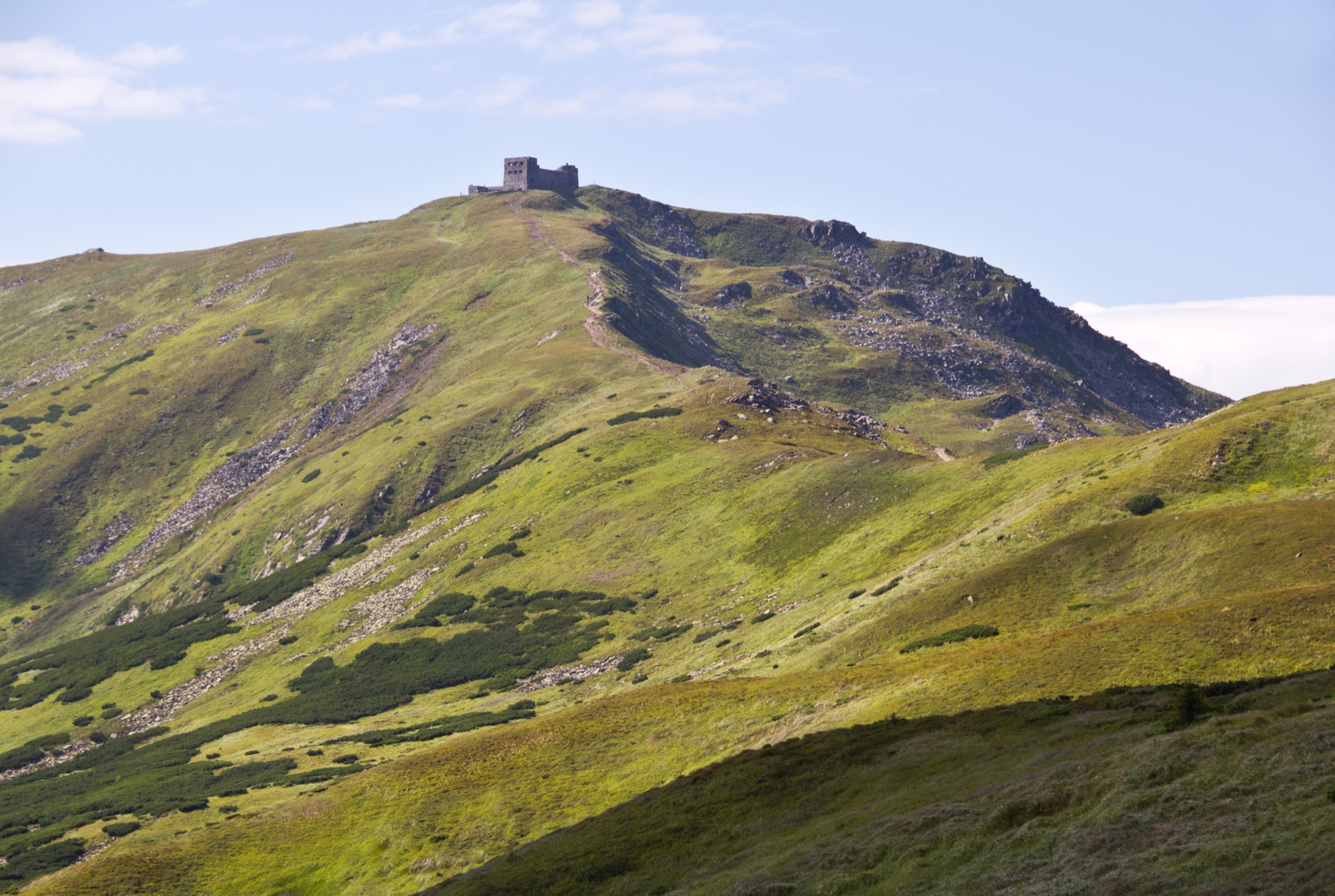
Pip Ivan from Dzembronya
An ascent of Pip Ivan Chornohirskyi (2028 m) from Dzembronya — past the waterfalls and Vukhatyi Kamin or over the top of Smotrych, out and back.
 MediumPermit: The route enters the border zone. The permit comes from the 31st Border Guard Detachment (DPSU): apply in advance with your route and dates; review takes up to 10 working days.
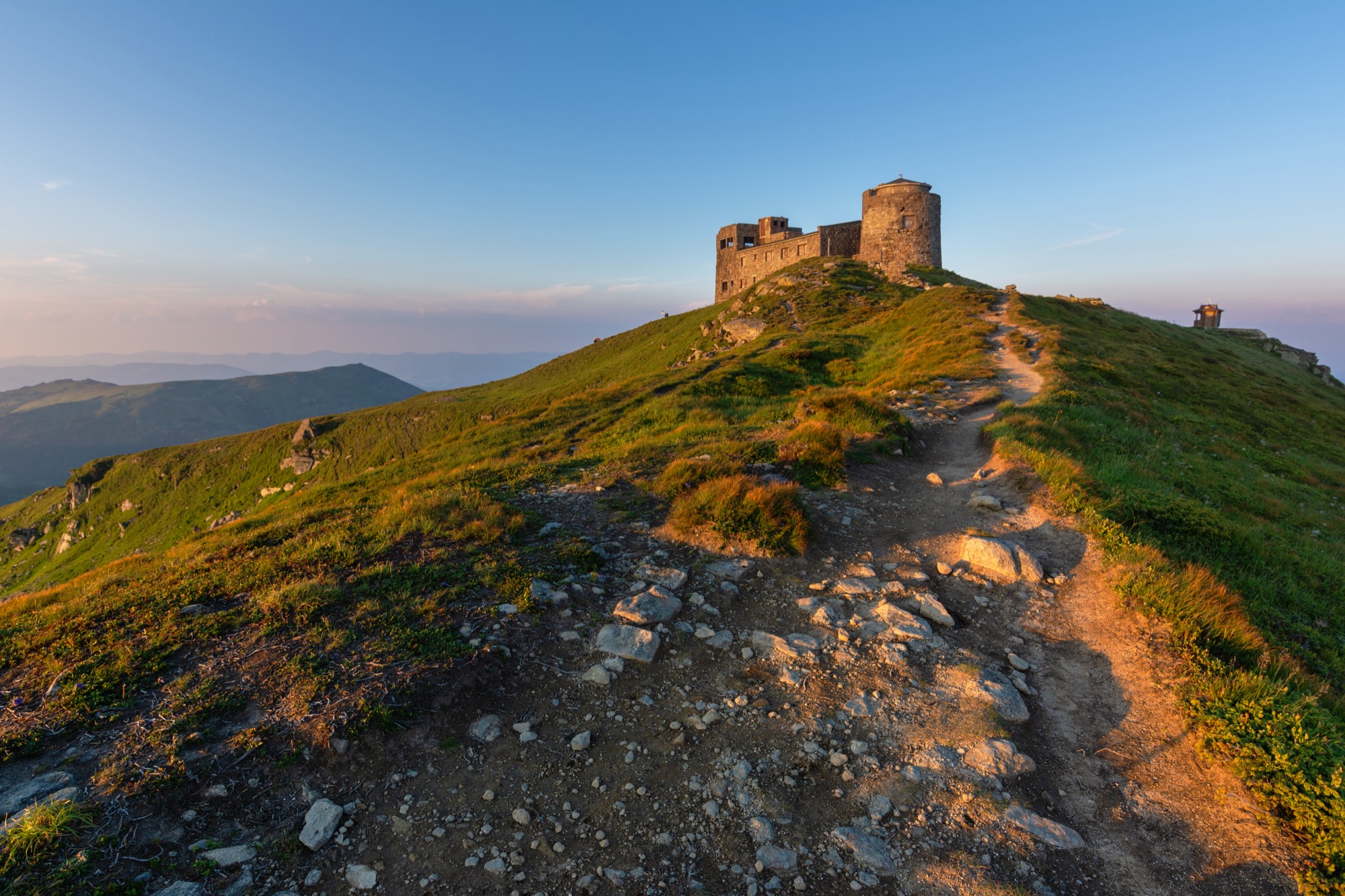
Pip Ivan from Shybene
An ascent of Pip Ivan Chornohirskyi (2028 m) from Shybene on the green trail — across the Vesnarka meadow and past Lake Maricheika, out and back.