Bystrets — Shpytsi · out and back
- Distance
- 22 km · out and back
- Elevation gain
- ↑ 1195 m
- On the trail
- ≈ 11 h, estimate
- Highest point
- 1863 m
- Trailhead elevation
- ~763 m · Bystrets
- Max steepness
- ≈39% over 200 m
- Difficulty
- Medium
ROUTE OVERVIEW
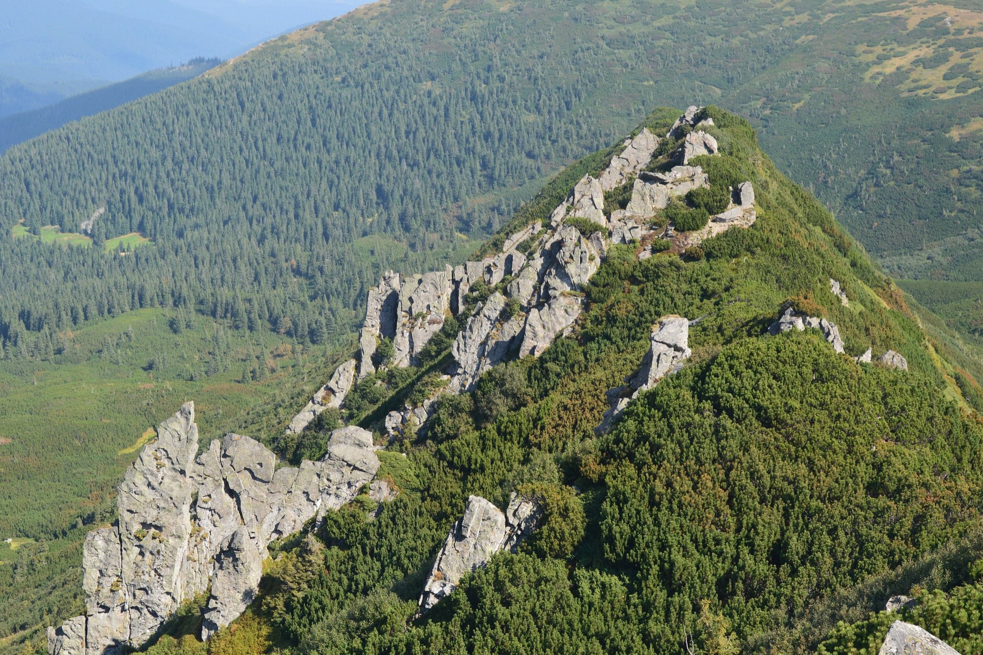
Rows of rock of Oligocene Magura sandstone — up to fifteen, by some counts.
A hike to Shpytsi (1863 m), a rocky crest in the central part of Chornohora, from the village of Bystrets. A waymarked green trail leads 4.5 km along a road, then on a forest road up to the Maryshevska meadow and on a path to the top. Back the same way.
The green waymarks are given by OpenStreetMap, Wikivoyage and karpaty.rocks. The waymarked trail passes 100 m from the summit and goes on to the saddle; an unmarked path along the crest leads to the top itself, for the last 300 m.
According to Wikipedia, the Shpytsi rocks are mostly Oligocene Magura sandstone; by some accounts there are as many as 15 rows of them.
There are springs by the trail at kilometres 5 and 8 (karpaty.rocks). No source gives a time out and back: karpaty.rocks puts it at about 6 hours of walking without stops one way only, for the whole trail up to the main ridge. So the time on this page is an estimate. Mountain weather changes fast, so carry a rain shell and a warm layer, and turn back in a thunderstorm or fog.
In autumn daylight in Bystrets shrinks from 13.4 hours in early September to 8.7 at the end of November, and from mid-October it is shorter than the estimated 11 hours. So late in autumn part of the way will most likely be walked in the dark: carry a headlamp.
- Shpytsi is 1863 m
- A waymarked green trail leads from Bystrets over the Maryshevska meadow
- The Shpytsi rocks, by some accounts up to 15 rows of them, are mostly Oligocene Magura sandstone
Elevation profile
22 km · ↑ 1195 m
Route map
All routes on the mapSTAGE BY STAGE
- 0 kmBystretsStart of the green trail in the village
- 4.5 kmEnd of the roadA forest road from here; several fords around kilometre 5
- 7.5 kmMaryshevska meadowA ford and the ruins of a hikers' shelter on the meadow
- 8.9 kmStart of the pathThe forest road turns into a path; a resting place at km 9.5
- 11 kmShpytsiThe summit; the last 300 m on an unmarked path along the crest. Back the same way1863 m
- 22 kmBystretsBack the same way
BEFORE YOU GO
Neither Shpytsi nor the Maryshevska meadow is on the list of places the State Border Guard Service closed to visitors without a permit (order of the 31st Border Guard Detachment No. 1663-АГ of 23 May 2024, checked 1 November 2026). The mountain lies in the Carpathian National Nature Park. Past Shpytsi the green trail goes on to the main ridge by Mount Rebra; Mount Turkul on the ridge is on the list. The route itself needs no permit, but the road to Bystrets passes a border-guard checkpoint, which checks an application to the 31st detachment and documents: by posts of 31 July and 1 August 2023, a group that arrived without waiting for an answer was turned back, and in the words of the guard on duty the permit is required of men who are Ukrainian citizens, not of women and children. By a review of 31 July 2026 the checkpoint checked the application sent and military registration documents. So apply to the detachment in advance to pass the checkpoint and do not set out without an answer; carry an ID document and, for men aged 18–60, a military registration document. How to apply for the permit
IF SOMETHING HAPPENS
- 101State Emergency Service — mountain emergency call
- 112Single emergency number: goes through any network in range, even without your carrier’s coverage
- Rescue in the MountainsThe rescue service’s app, install in advance — it sends your coordinatesApp StoreGoogle Play
- "White Elephant" observatory (Pip Ivan)Rescue post · ≈ 9.5 km in a straight line from the start