Zaroslyak — Lake Nesamovyte · out and back
- Distance
- 14 km · out and back
- Elevation gain
- ↑ 658 m
- On the trail
- 6–7 h
- Highest point
- 1750 m
- Trailhead elevation
- ~1265 m · Zaroslyak
- Max steepness
- ≈45% over 200 m
- Difficulty
- Easy
ROUTE OVERVIEW
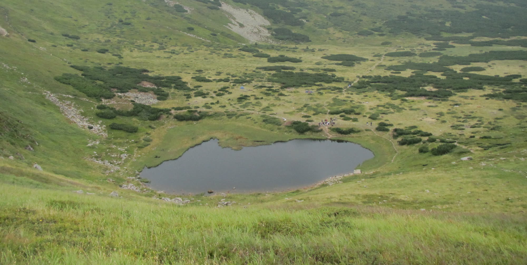
A glacial lake 88 by 45 metres in a cirque on the eastern slope of Turkul.
Nesamovyte is a glacial lake at 1750 m in a cirque on the eastern slope of Mount Turkul. It is small: 88 by 45 m, 1–1.5 m deep on average.
A yellow waymarked trail leads to the lake from the Zaroslyak base. It starts in the forest, comes out on the Pozhyzhevska meadow by the Pozhyzhevska weather station and then climbs to the lake. The way back is the same trail. Out and back, according to Hutshub, takes 6–7 hours, not counting a rest at the lake.
Mount Turkul above the lake is on the list of places the State Border Guard Service closed to visitors without a permit (23 May 2024). The lake itself is not named on it, so do not climb on to Turkul's summit from this route.
- The lake lies at 1750 m
- Glacial in origin — in a cirque on the eastern slope of Mount Turkul
- 88 m long, 45 m wide, 1–1.5 m deep on average
- A yellow waymarked trail leads to it from the Zaroslyak base
Elevation profile
14 km · ↑ 658 m
Route map
All routes on the mapSTAGE BY STAGE
- 0 kmZaroslyakTrailhead at the «Start to Hoverla» sign; the «To Lake Nesamovyte» signpost is next to it~1265 m
- 1.8 kmPozhyzhevska meadowThe trail leaves the forest for the meadow; the Pozhyzhevska weather station is nearby
- 4.9 kmDantsezhyk waterfallA waterfall by the trail
- 7 kmLake NesamovyteGlacial lake below Turkul; back the same way1750 m
- 14 kmZaroslyakBack the same way~1265 m
BEFORE YOU GO
Zaroslyak and the lake lie in the Carpathian National Nature Park: a visitor fee is charged at the park entrance. Mount Turkul above the lake is on the list of places the State Border Guard Service closed to visitors without a permit (23 May 2024); the lake itself is not named on it.
IF SOMETHING HAPPENS
- 101State Emergency Service — mountain emergency call
- 112Single emergency number: goes through any network in range, even without your carrier’s coverage
- Rescue in the MountainsThe rescue service’s app, install in advance — it sends your coordinatesApp StoreGoogle Play
- Zaroslyak postRescue post · at the start of the route